Hurricane Idalia is expected to become a Category 3 storm — here’s what that means and how Florida residents can stay safe
WATCH LIVE: DeSantis gives update on Hurricane Idalia as dangerous storm barrels toward Florida
Gov. DeSantis gives update on Hurricane Idalia as dangerous storm barrels toward Florida
Hurricane Idalia's approach has resulted in mandatory and voluntary evacuations in western and north central parts of Florida.
Gov. Ron DeSantis declared a widespread state of emergency that affects dozens of counties that are likely in the Category 1 hurricane’s path. It has just been upgraded to a Category 2 storm and is expected to strengthen to Category 3 when the storm makes landfall on Wednesday.
On Tuesday, Aug. 29, the governor’s office updated its state of emergency to include 49 counties in a new emergency management briefing.
FOX WEATHER ANNOUNCES SPECIAL PROGRAMMING TO COVER HURRICANE IDALIA
Here is some key information to know to stay safe and protect life and property.
Hurricane Idalia: Florida counties under state of emergency
The office of the governor added coastal and inland counties in Central and North Florida to its state of emergency.
These include Alachua, Baker, Bay, Bradford, Brevard, Calhoun, Charlotte, Citrus, Clay, Collier, Columbia, DeSoto, Dixie, Duval, Flagler, Franklin, Gadsden, Gilchrist, Gulf, Hamilton, Hardee, Hernando, Hillsborough, Jefferson, Lafayette, Lake, Lee, Leon, Levy, Liberty, Madison, Manatee, Marion, Nassau, Orange, Osceola, Pasco, Pinellas, Polk, Putnam, Sarasota, Seminole, St. Johns, Sumter, Suwannee, Taylor, Union, Volusia and Wakulla Counties.
Mandatory evacuation orders have been issued largely for counties that are along Florida’s west coast, according to FloridaDisaster.org, a division of the State Emergency Response Team.
Hurricane safety: What are the dangers?
Storm trackers apply the Saffir-Simpson Hurricane Wind Scale to assess hurricane hazards on a scale of one-to-five — with five being the highest level of property damage and danger.
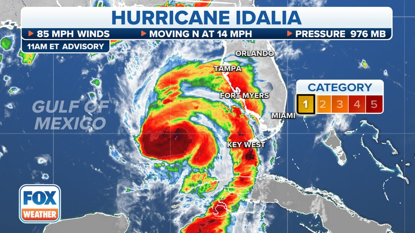
Hurricane Idalia's current location is shown as of midday Tuesday, Aug. 28. (FOX Weather)
Here are the differences between the hurricane categories, according to the National Weather Service (NWS).
Category 1 hurricanes produce winds that are between 74 and 95 mph and are predicted to have "very dangerous winds" that’ll result in "some damage." This damage can include destruction to roofs, shingles, vinyl side and gutters, broken branches and the potential toppling of shallow-rooted trees and power lines.
Category 2 hurricanes produce winds that are between 96 and 110 mph and are predicted to have "extremely dangerous winds" that will result in "extensive damage," such as major destruction to roofs and siding, potential toppling of many shallow-rooted trees and near-total power loss with outages that can last days or weeks.
HURRICANE IDA POWER OUTAGES AND FOOD SAFETY: HOW MANY HOURS UNTIL REFRIGERATED FOOD IS UNSAFE
Category 3 hurricanes produce winds that are between 111 and 129 mph and are predicted to yield "devastating damage" that’ll result in major destruction. This can include severe damage or removal of roof decking and gable ends, many snapped or uprooted trees and loss of electricity and water for several days or weeks.
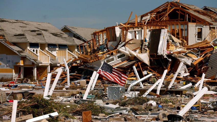
An American flag flies among rubble left in the aftermath of Hurricane Michael in Mexico Beach, Florida, on Oct. 11, 2018. (REUTERS/Jonathan Bachman)
Category 4 hurricanes produce winds that are between 130 mph and 156 mph. These hurricanes can result in "catastrophic damage" with severe destruction to most roof structures and/or some exterior walls; most trees will be snapped or uprooted; and power poles will be downed, with power outages that can last weeks or months. In addition, certain areas will be uninhabitable for an extended period.
TROPICAL STORM AND HURRICANE SAFETY CONSIDERATIONS EVERYONE SHOULD KNOW
Category 5 hurricanes produce winds that are between 157 mph or higher. They’re also predicted to yield "catastrophic damage" that’ll result in a high percentage of framed homes being "destroyed, with total roof failure and wall collapse."
Hurricane safety: Beware of floods
Storm surges — an abnormal rise of water generated by tropical storms or hurricane winds — are another major hazard that cause property damage and deaths, according to the NWS.
"Storm surge and large battering waves can result in large loss of life and cause massive destruction along the coast," the NWS wrote on a Hurricane Safety Tips and Resources webpage.
ON THIS DAY IN HISTORY, AUGUST 29, 2005, HURRICANE KATRINA SLAMS GULF COAST, CAUSING MASSIVE DAMAGE
"Storm surge can travel several miles inland, especially along bays, rivers, and estuaries," the weather agency added.
Other water-related hurricane hazards the NWS lists include flooding from heavy rains that can persist several days after the storm had dissipated and dangerous waves that can cause deadly rip currents, beach erosion and destruction of coastal structures.
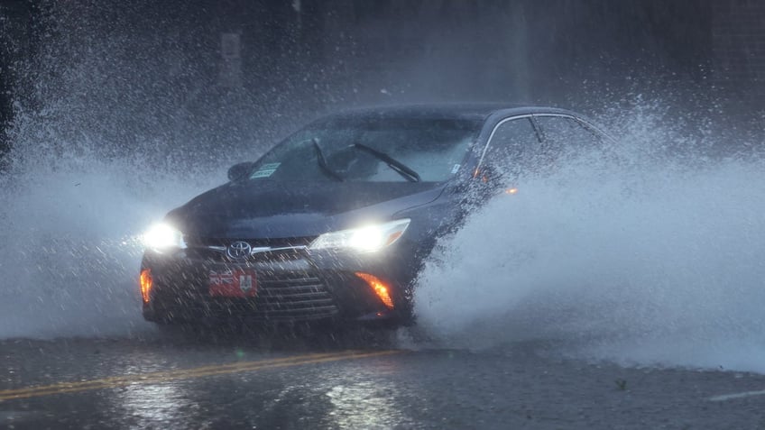
A vehicle drives down a flooded street as rain from Hurricane Ian drenches the city on Sept. 30, 2022, in Charleston, South Carolina. (Scott Olson/Getty Images)
The National Hurricane Center reports that most of the hurricane-related deaths that have happened in the U.S. were caused by water, including storm surges and floods, according to data the agency analyzed from 1963 to 2012.
Hurricane safety: Evacuation orders and what to pack?
Various emergency response authorities strongly urge citizens in hurricane zones to follow state of emergency guidance.
Those who live in mandatory evacuation zones are urged to comply with state recommendations.
Florida residents can check their evacuation status and flood zone risks on county websites, official social media accounts and FloridaDisaster.org’s "Know Your Zone" map.
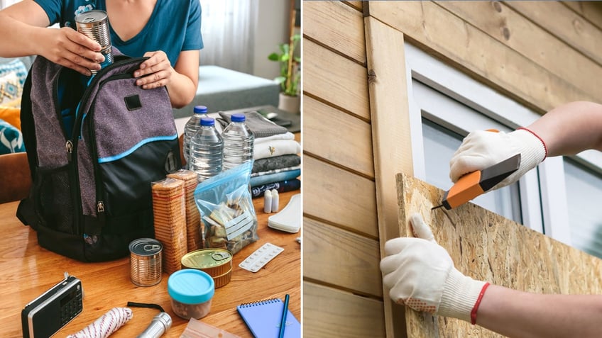
Safety experts suggest that emergency evacuees pack food, water, clothes, toiletries and first aid kits — these are essential items that should be packed in "go bags." They also suggest that non-evacuees board windows that don't have hurricane impact strength. (iStock)
Hurricane and disaster preparation experts recommend having basic emergency supplies and "go bags" ready before severe weather or natural hazard arrives.
The U.S. Department of Homeland Security’s has identified a list of "Basic Disaster Supplies" on the agency’s Ready.gov website, which outlines which items should pack in evacuation go bags and shelter-in-place kits.
Basic emergency supply kit per Ready.gov
Non-perishable food and water (gallon per person per day)
Extra cell phone batteries or chargers
Battery-powered or hand crank radio
CLICK HERE TO SIGN UP FOR OUR LIFESTYLE NEWSLETTER
Flashlights and extra batteries
First aid kit
Whistle
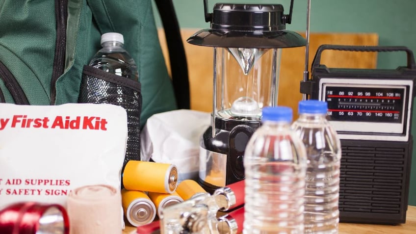
Emergency preparedness supplies for escaping natural disasters should include flashlights, backpacks, batteries, water bottles, first aid kits, lanterns, radios, can openers and face masks. (iStock)
Dust masks
Plastic sheeting and duct tape
Moist towelettes, garbage bags and plastic ties for personal sanitation
Non-sparking wrench or pliers
Manual can opener
Local maps
FOLLOW US ON FACEBOOK FOR MORE FOX LIFESTYLE NEWS
Additional emergency supplies that people might want to pack in their go bags or at-home kits include hygiene and disinfectant products, prescription and over-the-counter medications, eyeglasses or contact lenses, infant formula, baby supplies, pet food, cash, checkbooks, copies of bank records, insurance polies, IDs, sleeping bags or blankets, clothes, fire extinguishers, matches, mess kits, paper cups, plates, paper towels and plastic utensils, paper, pencils, books, games and puzzles.
Hurricane safety: Fortifying homes
Residents living in hurricane zones should consider having materials to fortify their homes, including wood planks for boarding windows, according to the NWS’s What to Do Before the Tropical Storm or Hurricane webpage.
Homeowners should also keep trees trimmed, declutter gutters, bring loose outdoor furniture indoors, secure all doors and move cars into garages or another secure location, according to the NWS and Ready.gov.
Storm forecasts and updates should be monitored before, during and after a hurricane passes, both agencies say.
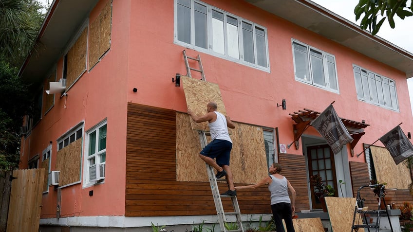
Edward Montgomery and Courtney Viezux board up Montgomery's apartment building as they prepare for the possible arrival of Hurricane Ian on Sept. 27, 2022, in St Petersburg, Florida. (Joe Raedle/Getty Images)
"Stay away from windows, skylights and glass doors," the NWS warns.
"If the eye of the storm passes over your area, there will be a short period of calm, but at the other side of the eye, the wind speed rapidly increases to hurricane force winds coming from the opposite direction."
Ready.gov recommends avoiding floodwaters outside and moving to higher levels if floodwaters enter a building or house.
Homeowners shouldn't hide in closed attics because they can become trapped by rising floodwater, according to the disaster preparedness website.
The NWS and Ready.gov strongly suggests Hurricaine zone residents who are weathering the storm at home to have backup plans for emergency evacuation, which includes knowing where nearby shelters are, filling vehicle gas tanks and determining meetup spots if households are separated.
Cortney Moore is an associate lifestyle writer on the Lifestyle team at Fox News Digital.
