A winter storm earlier this week ended a nearly two-year snow drought in cities including Washington, DC, Baltimore, and New York City. Another storm threatens metro areas along the I-95 Corridor on Friday morning.
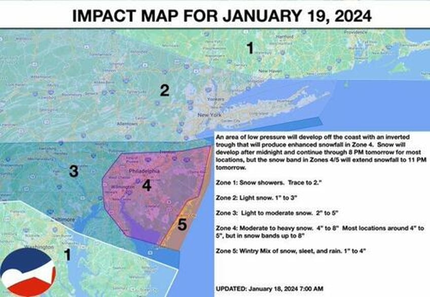
Private weather forecaster NY NJ PA Weather wrote on social media platform X that a "winter storm is developing from Philadelphia to the New Jersey coast."
"Tranquil and cold conditions today will give way to a significant winter storm by tomorrow for the Philadelphia metropolitan areas to the New Jersey Coast," the weather firm said.
The forecast calls for the bulk of the snow just north of Baltimore City to Philadelphia to Trenton; those areas are labeled in different zones with corresponding snowfall estimates.
In a separate forecast, meteorologist Mike Masco expects intense snowfall rates between Baltimore and Philadelphia.
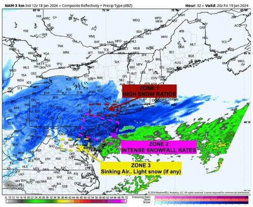
FRIDAY'S STORM WILL HAVE 3 ZONES TO CONSIDER... ONE ZONE WILL GET NEAR NOTHING WHILE THE OTHER GETS DUMPED ON WITH SNOW..
The dynamics of this system will dictate the forecast outcome. I've highlighted 3 zones as it relates to what the upper air pattern will be doing Friday- Friday Night and how it develops our #Norlun trough -- which will be responsible for "Intense" snow rates. If you've been following me.. I've been very specific that I like an area around #Philadephia esp it's NJ suburbs and northern DE into central NJ (mostly south of #NYC and the Driscoll Bridge).
Here's my 3 zones I'll be focusing in on.
Zone 1 (Lehigh Valley, NNJ, Northern Philly Suburbs): Is in the left front quadrant of the jetstreak allowing for enough lifting to produce light to moderate zone. This area will high MUCH higher snow ratios (nearing 20:1) during the event which will yield 2-4" (possibly localized more) as the area will work off limited moisture .15-.20" of QPF
Zone 2 (Central NJ, Southern NJ, Northern DE): Is the Hammer zone! It's the area that will see focused lifting at 700mb and 800mb, located in the left front quadrant of the jet streak, and have maximum moisture .20-.40" of QPF
Zone 3 (DMV/Baltimore): Is the "screw zone". This area is underneath the 500mb vorticity lobe but in the right front quad of the jetstreak thus sinking air will be prominent. The other factor is the intense snowrates and lifting over SNJ/DE/PA will lead to sinking air in another area and I do feel that will be over #Baltimore # DC area. I may need to revise my totals here a couple times once we get into now casting.
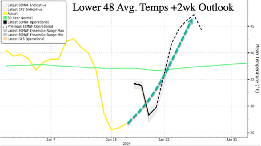
Another cold blast is expected this weekend for parts of the Lower 48.
The next Arctic Blast 2 -- which climate scientists say is caused by climate change -- will be weaker or "less worse" than Arctic Blast 1.
— Ryan Maue (@RyanMaue) January 18, 2024
Iowa will see the coldest temperatures > 40°F below normal Saturday morning.
Actual temperatures in the -20s °F in Iowa. But cold air… pic.twitter.com/vXpwnLfc01
After more than a week of most Americans freezing...
...global warming returns early next week across the nation.


