Weather forecasts indicate that the first major cold blast of the season will sweep into parts of the Lower 48 by the end of the month. This sudden chill comes shortly after corporate media pushed climate disinformation, warning about 'boiling' Earth and imminent destruction because of fossil fuel cars and cow farts. Even NOAA had to run far away from lying corporate media about the "hottest day ever" while 1,600 scientists around the world signed a declaration declaring there was no climate emergency.
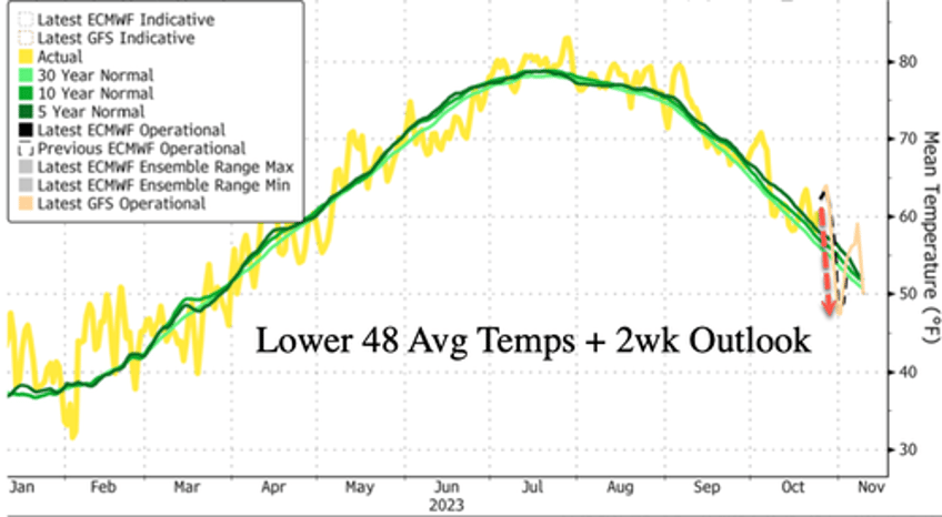
Bloomberg data shows Lower 48 temperatures, on average, will peak around 64F on Friday. Forecasts show the average temperature in the US will dive well below 5, 10, and 30-year trends to around 47F by next Wednesday.
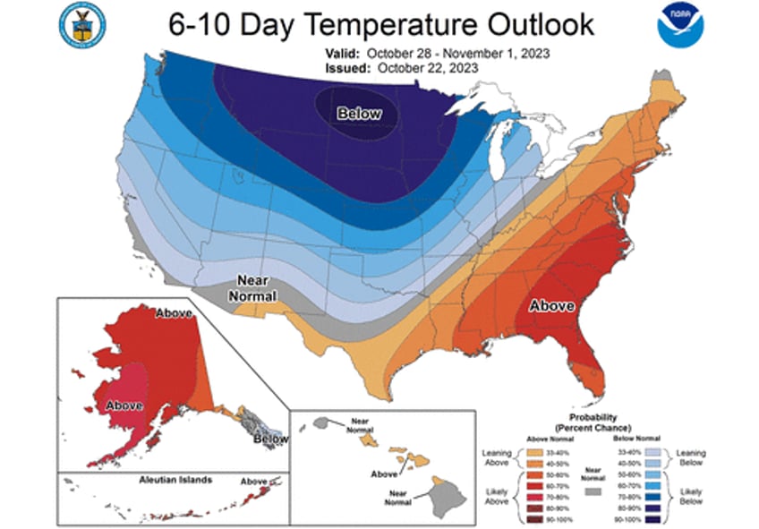
Looking at NWS' Climate Prediction Center's 6-10 day temperature outlook for the Lower 48, the forecast shows a large swath of the country will have very high probabilities of lower-than-average temperatures for this time of the year.
first polar vortex of the year pic.twitter.com/aihl6CIp0u
— zerohedge (@zerohedge) October 25, 2023
We penned several notes that an El Nino winter could leave some parts of the Lower 48 with a cold and snowy winter:
- The 'Brrr' Is Coming Back
- What Does Strong El Niño Mean For Winter Activity Across US?
- US Meteorologist Warns: "Winter This Year Going To Be Very Different" As El Nino Ramps Up
According to the weather blog Severe Weather Europe, the expected cold bast is due to "an early polar vortex event that will produce strong cold weather pattern change across Canada and the US."
Here's more about the current state of the polar vortex:
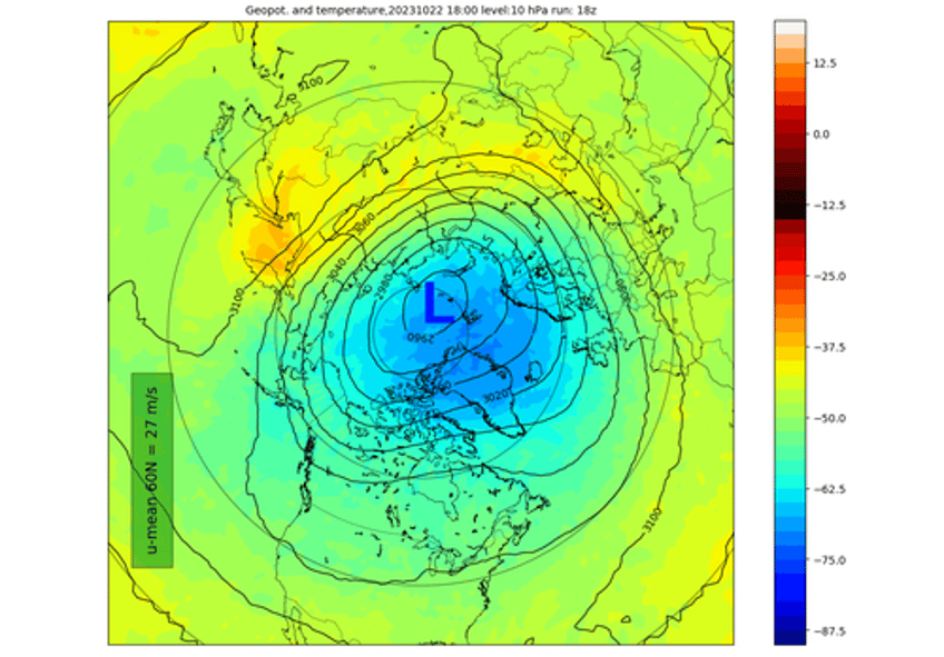
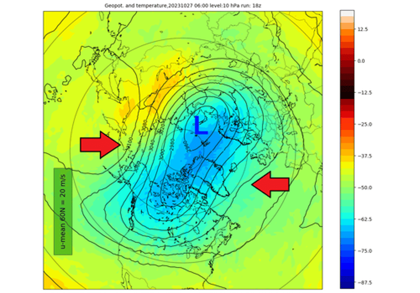
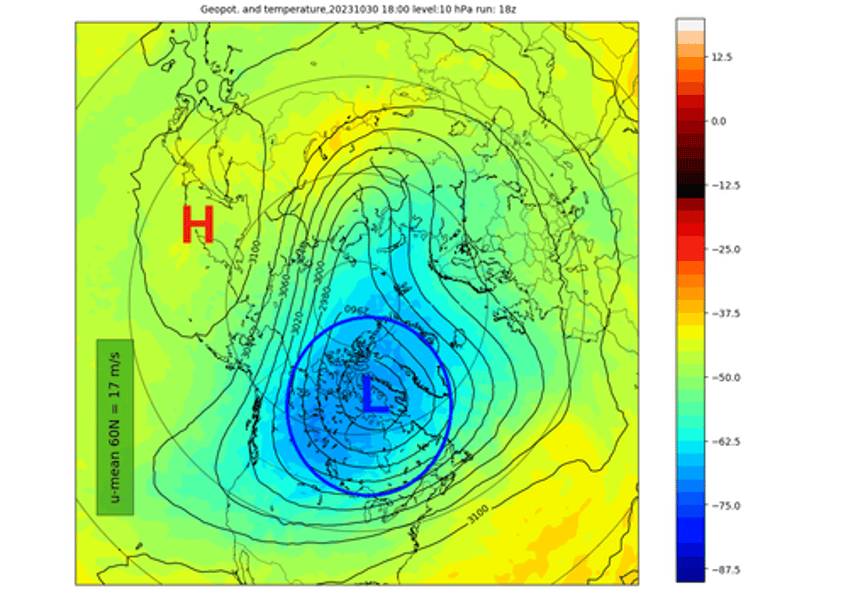
The Polar Vortex is currently normal in size and has a growing cold core over the polar regions. The image below shows geopotential height and temperature in the mid-stratosphere at the 10mb level (30km/18.5miles). The Polar Vortex looks like a "cyclone" with a cold core near its low-pressure center.
The image above is by weatheriscool.com
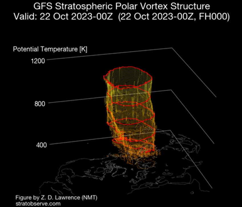
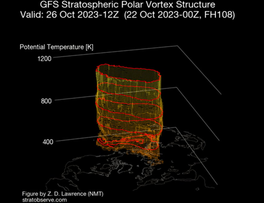
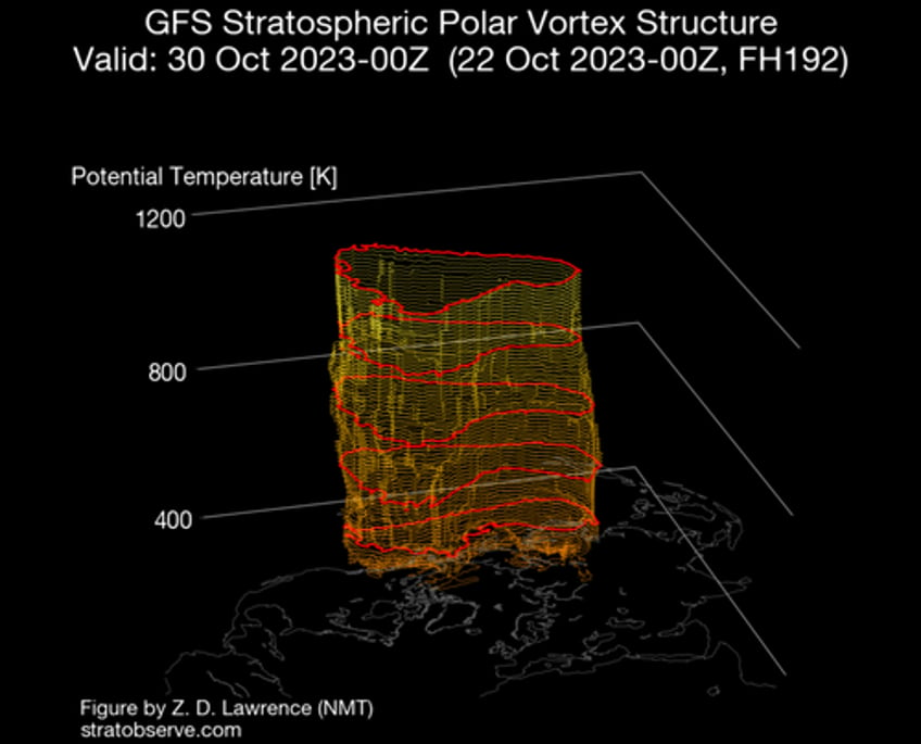
If we look at the 3D structure, we can fully see the current compact structure of the Polar Vortex. It is nicely organized and circular in shape. An organized/circular shape usually indicates that the Polar Vortex is strong.
But how do we measure the strength of the stratospheric Polar Vortex? The simple answer is the winds. More specifically, the stratospheric polar jet. The more organized the stratospheric polar vortex is, the stronger the winds inside it.
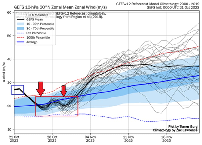
The image below shows the wind forecast for the polar vortex in the mid-stratosphere. The blue square is the current state. You can see that the polar vortex is currently stronger than normal. We already saw hints of that by looking at its shape and 3D structure.
But, notice a decent wind deceleration coming later in the month. That is a substantial weakening for this time of year. But how does such an abrupt weakening of the Polar Vortex even happen? We will look more closely at this event and how it will connect to our daily weather.
ABOVE AND BELOW IN THE ATMOSPHERE
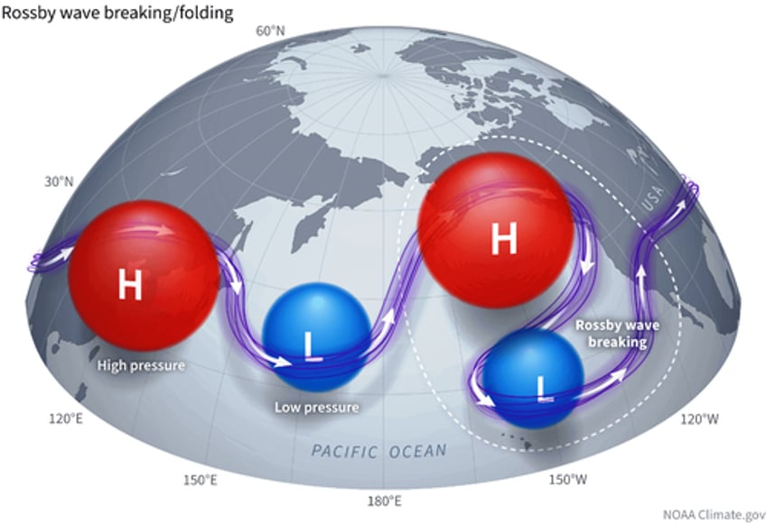
Polar Vortex disruption usually comes from below. It is from the direct influence of strong pressure systems, having an impact upwards into the Stratosphere. Pairs of pressure systems are also known as Rossby Waves. You can see an example of Rossby waves in the image below by NOAA.
Rossby Waves (a pair of strong high and low-pressure systems) deflect energy upwards into the Stratosphere as they break. That energy can deform the Polar Vortex, temporarily pausing its strengthening or weakening its circulation.
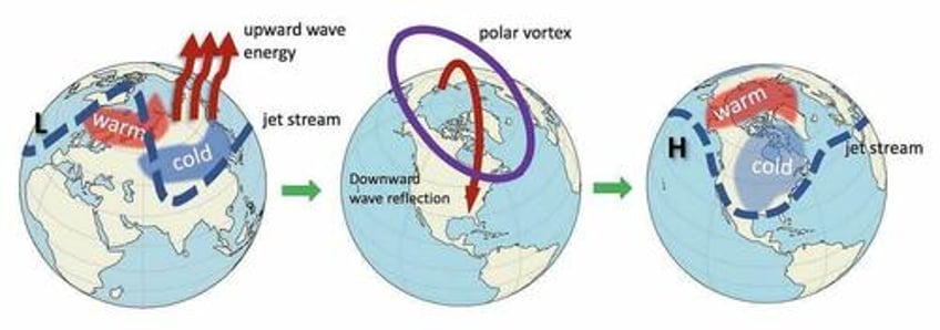
In the image below, you can see the vertical wave activity example. First, the energy goes into the Stratosphere, which impacts the Polar Vortex and later affects the polar circulation back down, changing the weather patterns as the Polar Vortex is disrupted.
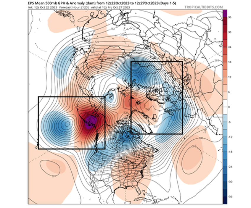
We can see the Rossby waves in the 5-day pressure forecast below. Notice the two marked zones with pairs of strong high and low-pressure regions. This setup enables the "wave breaking," sending energy upwards into the Stratosphere and disrupting the Polar Vortex dynamics.
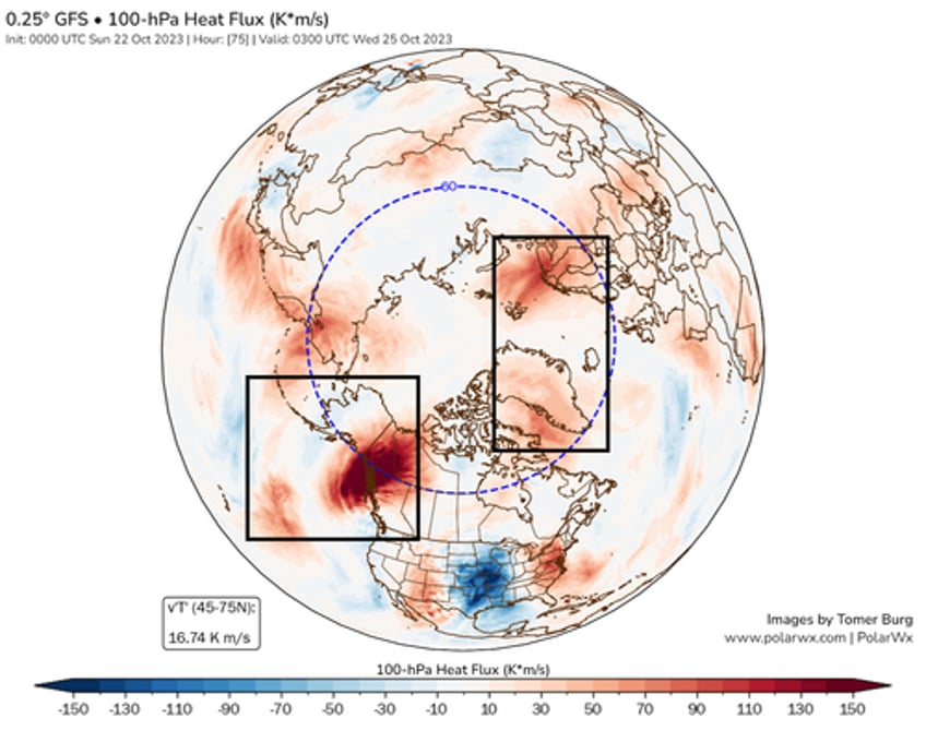
For that purpose, we have a special graphic from Tomer Burg. Below, you can see the 100mb heat flux chart. It shows the temperature transport on the border from the troposphere to the Stratosphere. Again, you can see strong regions with positive upward heat/energy transfer in the main Rossby wave-breaking activity area.
All this shows us that the strong pressure patterns in the lower levels can reflect a lot of energy upwards into the stratospheric Polar Vortex. We will now look at how the Polar Vortex is actually going to respond to these dynamics from below.
POLAR VORTEX UNDER PRESSURE
Looking at the forecast for later in the week, you can see in the forecast below where that energy manifests in the middle levels. The stratospheric Polar Vortex will get pressed from both sides, courtesy of the Rossby wave-breaking events. This is similar to squeezing a balloon with both hands, it gets deformed.
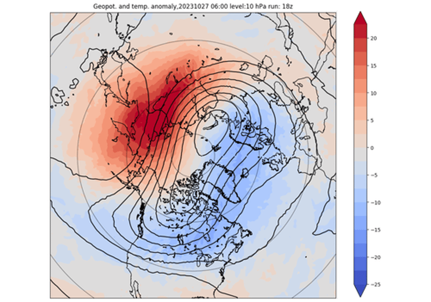
The temperature anomaly forecast for the same period also shows higher-than-usual temperatures emerging over the Siberian region. That works in tandem with a higher-pressure zone emerging over the North Pacific and compressing the Polar Vortex.
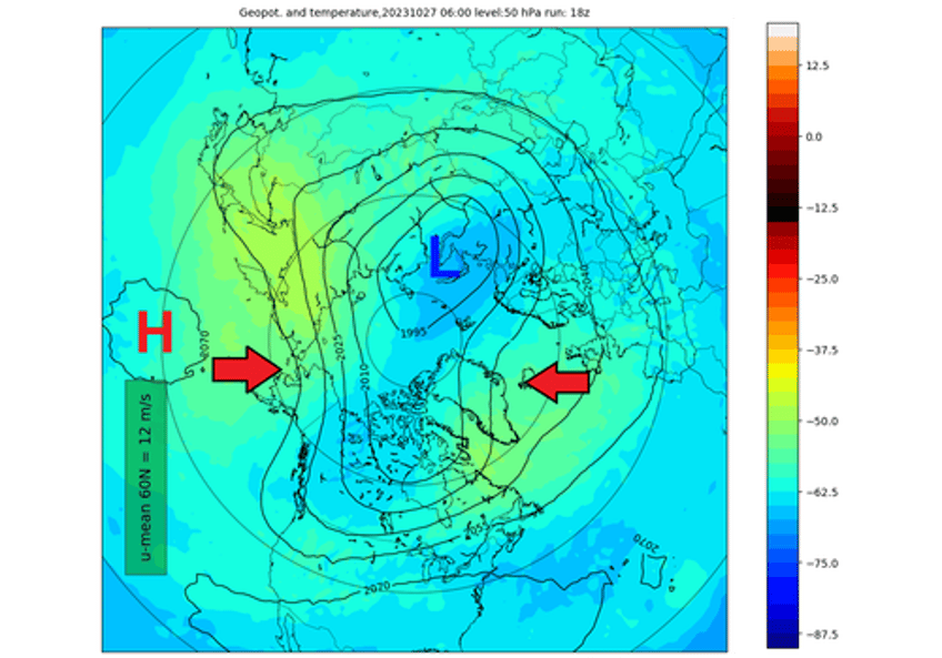
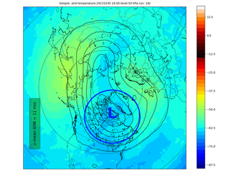
Below is a forecast for the 50mb pressure level in the Stratosphere at around 20km/12.5 miles altitude. Even lower in the Stratosphere, the Polar Vortex is compressed, with the main core sitting over the Polar regions.
You can see the whole event even better on the vertical 3D structure. The Polar Vortex is forecast to shift from a perfect circular shape to an elongated/deformed one. Being pressed from two sides, it is forecast to turn into a more oval shape, also seen in the forecast images above.
So what is the further progression of this event and the surface weather impacts?
WHEN WEATHER PATTERNS CHANGE
The evolution in the Stratosphere is quite straightforward. Going into next week, the Polar Vortex will remain compressed. But the big change is that the core of the Polar Vortex itself will position over Canada and the northern United States.
Lower down in the Stratosphere, you can see the same process, with the Polar Vortex core positioning over Canada. This shows a strong overall connection through all the layers of the atmosphere.
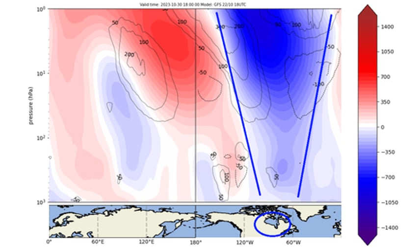
The vertical pressure anomaly structure is getting more important at this point. It can show connections points and changes in the pressure patterns.
The forecast below shows the vertical pressure anomalies for the same period. You can see the strong negative anomalies directly over Canada and the United States, connecting down from the Stratosphere. This is the actual core of the Polar Vortex.
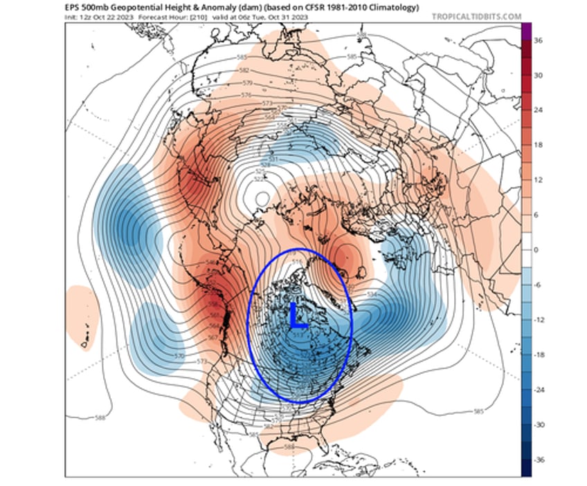
You can see this if we look at the pressure pattern in the lower levels. Notice the broad low-pressure area over Canada and the United States. This is the main connection to the stratospheric Polar Vortex, as far as pure anomalies go. This is a strong low-pressure system directly connected to the stratospheric Polar Vortex.
The vertical 3D structure reveals the continued elongated shape in this time period. But notice the broader area over North America, which is the relocated core of the Polar Vortex.
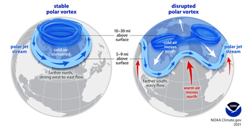
If you look closely at the Polar Vortex above, it has the same shape as a disrupted Polar Vortex example in the NOAA Climate graphic. This unlocks the arctic doors, allowing the cold air to move south into Canada and the United States.
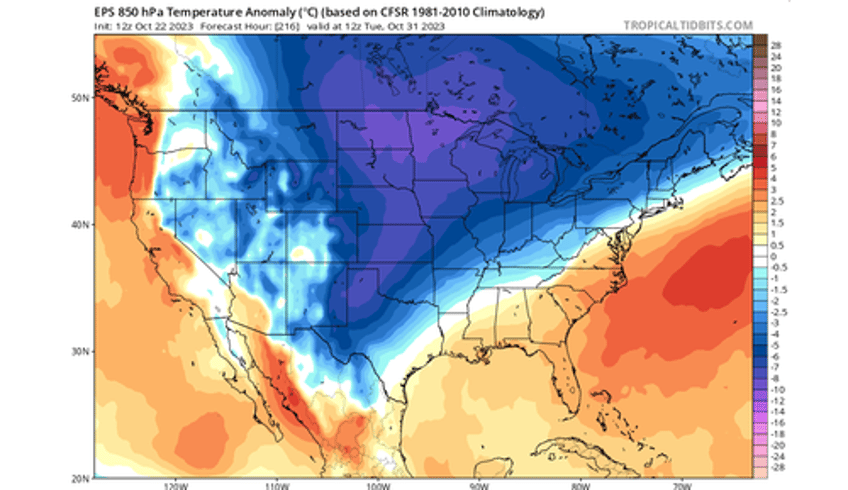
Looking at the temperature forecast for early next week, you can see the cold air engulfing much of Canada and the United States. This is because the lower Polar Vortex core area sits over the northeastern United States and northern Canada. That enables an unseasonably cold air flow down into the United States.
We will take a quick look at this cold air outbreak on a surface level. As the event gets closer, we will issue a more detailed forecast of the cold anomalies across southern Canada and the United States.
COLD AIR OUTBREAK
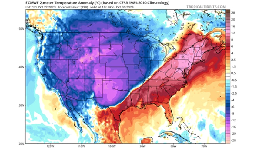
Looking at early next week, the cold air outbreak will begin with strong cold anomalies and unseasonably cold temperatures spreading from the north. The cold air outbreak will first cover much of the western and northern United States, the plains, and the Midwest.
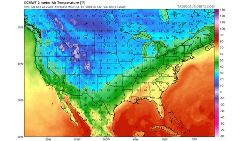
The image below shows the morning temperature forecast for next Tuesday. You can see temperatures at the freezing level or lower across a wide area of the United States, reaching from the northern United States into the Midwest and down across the Plains.
The NOAA official temperature forecast for 6-10 days ahead also shows the massive cold air anomaly spreading from the north. Warmer than normal temperatures will prevail over the eastern United States but are expected to move out as the cold wave progresses south and east over the week.
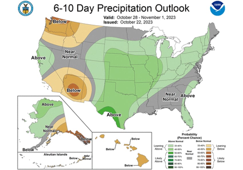
The official precipitation forecast for the 6-10 day range shows more precipitation from the southern United States, up across the plains, the Midwest, and into the Northeast. The highest snowfall potential is across the northern United States, northern Plains, and the upper Midwest.
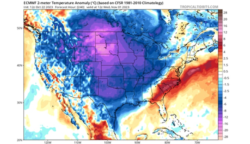
Going into mid-next week, the cold air will move further east. The warm anomalies across the eastern United will diminish as the cold wave reaches into the southern United States and moves further east.
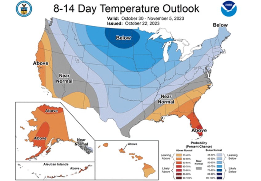
The official 8-14 temperature outlook shows the progression of the colder air into the southern and eastern United States, especially the Northeast. Warmer temperatures are expected to remain in the deep southeast and southwestern parts of the United States.
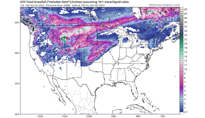
The latest model forecast shows snowfall across the mentioned area, with the main focus for snowfall potential being across the northern United States and the Central Plains.
Brrr is back.

