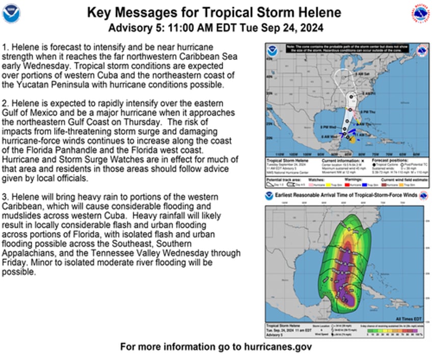
Tropical Storm Helene formed in the northwestern Caribbean on Tuesday morning and is forecasted to strengthen rapidly over the next few days, potentially making landfall along the coast of the Florida Panhandle and/or Florida west coast on Thursday.
As of late Tuesday morning, the National Hurricane Center's latest advisory note said TS Helene was churning about 180 miles east-southeast of Cozumel, Mexico, with maximum sustained winds of 45 mph. The storm is moving northwest at 12 mph and could become a hurricane as soon as Wednesday. The storm could rapidly strengthen into a major hurricane by late Wednesday, if not early Thursday, before landfall.
"The center of Helene will move across the far northwestern Caribbean Sea through tonight, then move across the eastern Gulf of Mexico Wednesday and Thursday, potentially reaching the Gulf Coast of Florida late Thursday," NHC said.
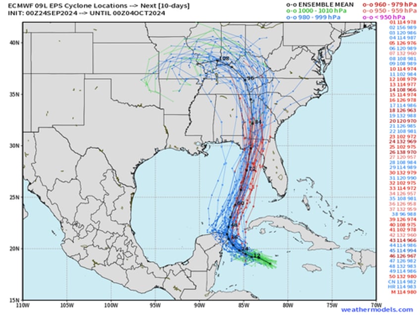
The latest weather models show TS Helene's cone of uncertainty making landfall around Florida's Big Bend region.
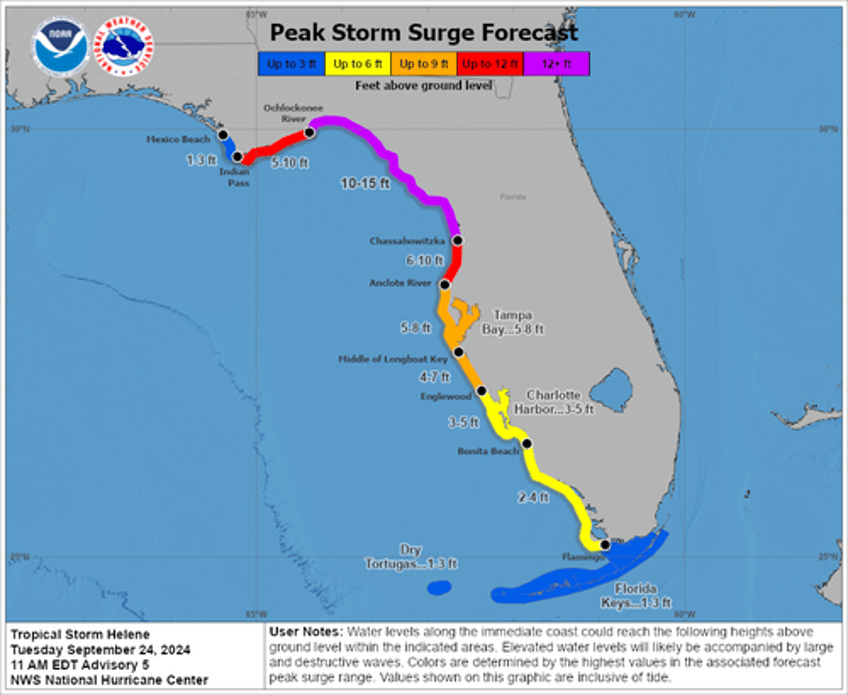
On Thursday, NHC forecasts huge storm surges, upwards of 12 feet or more in some areas, across the Big Bend region.
Florida Governor Ron DeSantis declared a state of emergency on Monday for 61 counties. He said the state of emergency covers "every county in Florida outside Southeast Florida."
DeSantis has requested a pre-disaster emergency declaration from FEMA. Several counties have already posted mandatory evacuations, including all residents in Charlotte and Franklin counties. Voluntary evacuations were issued for Gadsden County.
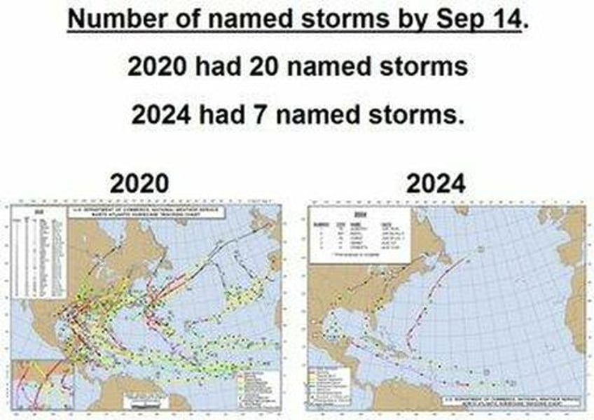
In late August, Hurricane Idalia made landfall near Keaton Beach, Florida. So far this hurricane season, the tropics have been very quiet despite climate alarmists in leftist corporate media warning everyone that 'boiling' sea temperatures will cause destructive mega storms.
It seems like the 'trust the science' crowd was very wrong.


