Around this time each year, strong trade winds over northwest Africa stir up Saharan dust, carrying it thousands of miles across the Atlantic Ocean, through the Caribbean Sea, and eventually over the US Gulf Coast. This year's first wave of Saharan dust is expected by the end of the month.
"Dust from Africa here the next 10 days. Will help keep things quiet it looks like this next week, especially in the Caribbean," Mike's Weather Page wrote in a post on X, along with a forecast model showing the dust will reach Florida and the rest of the Gulf Coast by next weekend.
Dust from Africa here the next 10 days. Will help keep things quiet it looks like this next week, especially in the Caribbean. Should make it to the US even and make some nice sunsets. https://t.co/Hk3pbO7x8H pic.twitter.com/Dx7jaoIgXy
— Mike's Weather Page (@tropicalupdate) June 22, 2024
The National Hurricane Center explained in a post on X that the dust would keep tropical activity low through next week.
June 22: Plentiful SAL across the Atlantic. The Saharan Air Layer (SAL) is a significant influence on Atlantic tropical weather from late spring through the early autumn. The hot, dry air can suppress hurricane development, and trade winds can carry the dust great distances. pic.twitter.com/6VuBnz1NSW
— NHC_TAFB (@NHC_TAFB) June 22, 2024
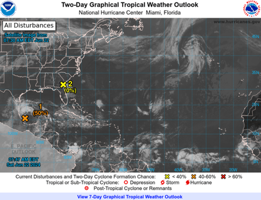
Current NHC data shows light tropical activity, with one active system in the southern Gulf of Mexico.
Before the Saharan dust arrives in South Florida, a heat dome has scorched parts of the eastern US for the past week, and this intense heat is expected to continue into next week.

