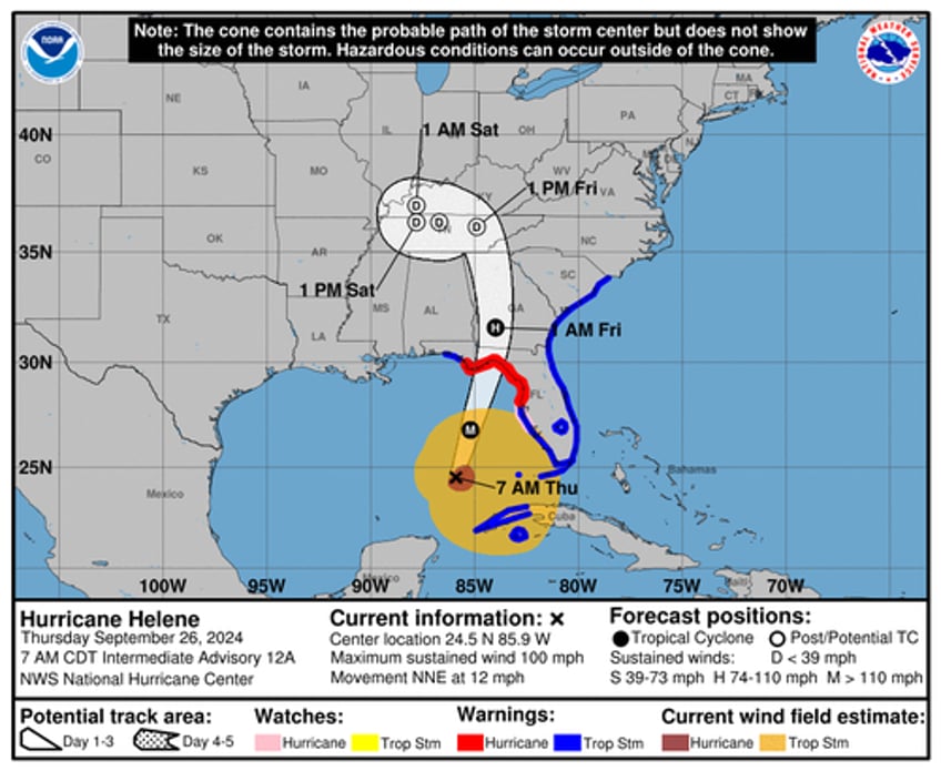
The National Hurricane Center has upgraded fast-moving Hurricane Helene to a Category 2 storm, with forecasts expecting further intensification to Category 3 or higher before it makes landfall on Florida's northwestern coast this evening.
.@NOAA's #GOESEast satellite is continuing to closely monitor #HurricaneHelene this morning as it approaches Florida.
— NOAA Satellites (@NOAASatellites) September 26, 2024
Latest updates and advisories on #Helene: https://t.co/0TM09un8F8 https://t.co/TzgxFVw1Pd pic.twitter.com/j2sfVg7SQk
Early Thursday, Helene was churning about 350 miles southwest of Tampa, moving north-northeast at 12 mph with maximum sustained winds in excess of 90 mph.
Hurricane #Helene Advisory 12A: Helene Becomes a Category 2 Hurricane With Significant Additional Strengthening Expected Before Landfall in Florida. Preparations to Protect Life and Property Should Be Rushed To Completion. https://t.co/tW4KeGe9uJ
— National Hurricane Center (@NHC_Atlantic) September 26, 2024
"Helene will make landfall along the Florida Big Bend coast this evening as a Major Hurricane. While exact impacts will be heavily dependent on the track, expect catastrophic wind damage across the Big Bend and into southern Georgia," NHC wrote in an overnight forecast.
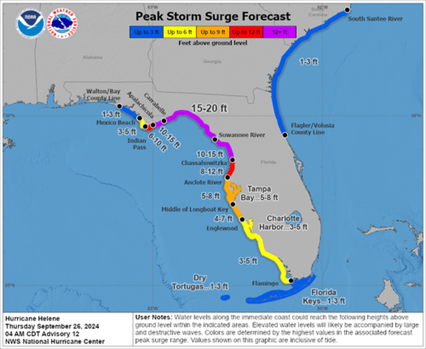
"There is a danger of catastrophic and unsurvivable storm surge for Apalachee Bay," NHC warned. Parts of Florida's northwestern coast could expect storm surges of up to 20 feet.
The National Weather Service office in Tallahassee called the forecasted storm surge for the Apalachee Bay area a "nightmare surge scenario," warning residents to "Please, please, please take any evacuation orders seriously!"
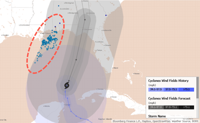
So far, Helene's cone of uncertainty forecast misses critical energy offshore platforms and major refineries in the Gulf area.


