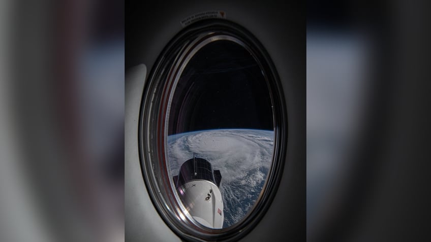
Matthew Dominick, a NASA astronaut and US Navy Commander, shared video of Hurricane Milton from space
Astronaut shares timelapse video of Hurricane Milton from space
NASA astronaut Matthew Dominick shared his view of Hurricane Milton from space in a timelapse video. (Credit: Matthew Dominick via Storyful)
A NASA astronaut shared ominous pictures and a video timelapse of Hurricane Milton from space.
The massive storm has now regained Category 5 strength as it barrels toward Florida.
"We flew over Hurricane Milton about 90 minutes ago. Here is the view out the Dragon Endeavour window. Expect lots of images from this window as this is where I’m sleeping while we wait to undock and return to Earth," Matthew Dominick, a NASA astronaut and U.S. Navy Commander shared in a post on X.
The video, posted on Tuesday morning, shows the spaceship gliding in space over the U.S. with Milton clearly visible.
FLORIDIANS PREPARE FOR THE WORST AS HURRICANE MILTON QUICKLY APPROACHES

A NASA astronaut shared a timelapse video of Hurricane Milton from space. (X/@dominickmatthew)
Dominick said the video was taken from 1/6400 sec exposure, 14mm, ISO 500, 0.5 sec interval, 30fps.
"Hard to wrap your head around the sheer size and power of these storms. Thanks for sharing your perspective!" one user commented on the video.
"That's a breathtaking perspective on the immense scale and the distinct eye formation at the center," another user commented.
"Hurricane Milton looks massive, even from Space!" another user wrote.
Dominick, a native of Wheat Ridge, Colorado, shared the video of Milton from the Dragon Endeavour 5, which is a crewed space capsule designed by SpaceX to ferry crews to the International Space Station. It is on a six-month stay, according to the NASA website.
BIDEN SAYS HURRICANE MILTON COULD BE 'WORST STORM TO HIT FLORIDA IN OVER A CENTURY'
Timelapse flying by Hurricane Milton about 2 hours ago.
— Matthew Dominick (@dominickmatthew) October 8, 2024
1/6400 sec exposure, 14mm, ISO 500, 0.5 sec interval, 30fps pic.twitter.com/p5wBlC95mx
Milton had maximum sustained winds of 150 mph and was moving in an east-northeast direction at 9 mph, the hurricane center said in a Tuesday update.
Milton is expected to bring a deadly storm surge, destructive winds and flooding rain, Fox Weather reports. Forecasters warned of a possible 10- to 15-foot storm surge in Tampa Bay. It is the highest surge ever predicted for that location and has led to evacuation orders for communities all along the coast.
Over the weekend, Florida Gov. Ron DeSantis declared a state of emergency for 51 of the state’s 67 counties.
Tampa Mayor Jane Castor issued a dire warning for those who choose to stay behind in mandatory evacuation zones as Hurricane Milton barrels toward Florida.

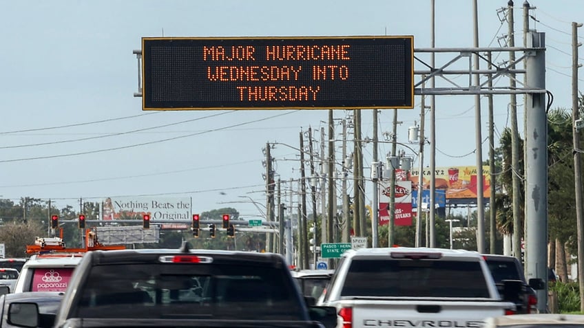
Highway signage announces the impending arrival of Hurricane Milton and the evacuation zones on Tuesday, Oct. 8, 2024, in Port Richey, Fla. (AP Photo/Mike Carlson)
"Helene was a wake-up call, this is literally catastrophic," Castor said on CNN. "If you choose to stay in one of those evacuation areas, you are going to die."
Hurricane Milton comes less than two weeks after Hurricane Helene devastated Florida, Georgia, South Carolina, North Carolina, Tennessee and Virginia.
At least 232 people have lost their lives across seven states, with North Carolina bearing the brunt of the devastation and with that number expected to rise.
While power outages have fallen below 2 million for the first time since the storm, approximately 1.6 million homes and businesses remain without electricity in the hardest-hit states as of Tuesday.
Helene is now the second-deadliest hurricane to strike the mainland U.S. in the last 55 years, topped only by Hurricane Katrina in 2005 and the most since Hurricane Camille hit the Gulf Coast in August 1969.
Fox News Digital's Bailee Hill, Steven Yablonski, Chris Oberholtz and Pilar Arias contributed to this report.
