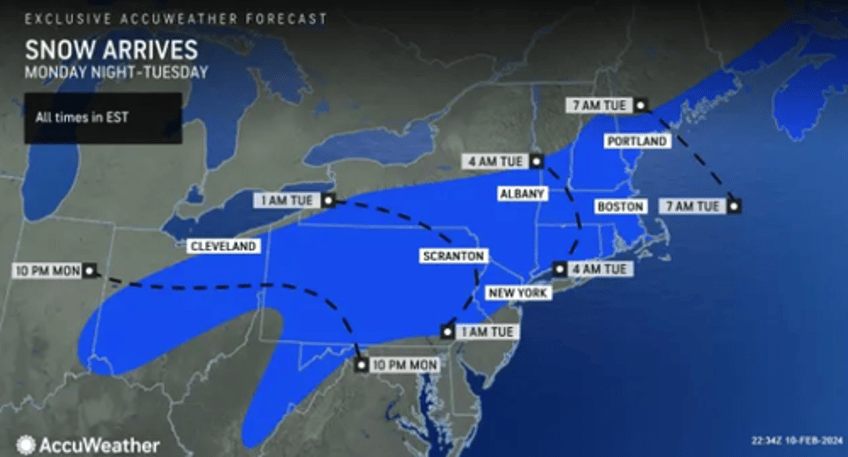
Unseasonably warm temperatures in the Northeast are ending to start the week as a snowstorm approaches. We have been following a "pattern change" since mid-last week, warning days ago of the increasing possibility of a snowstorm impacting the Mid-Alantic and Northeast regions.
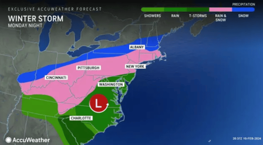
AccuWeather meteorologists say Ohio Valley, Mid-Atlantic, central Appalachians, and southern New England will see rain or a mixture of rain, wet snow, and sleet to start Monday. By night, portions of the central Appalachians, the upper mid-Atlantic, and New England will transition to all snow, and some areas could receive significant accumulation.
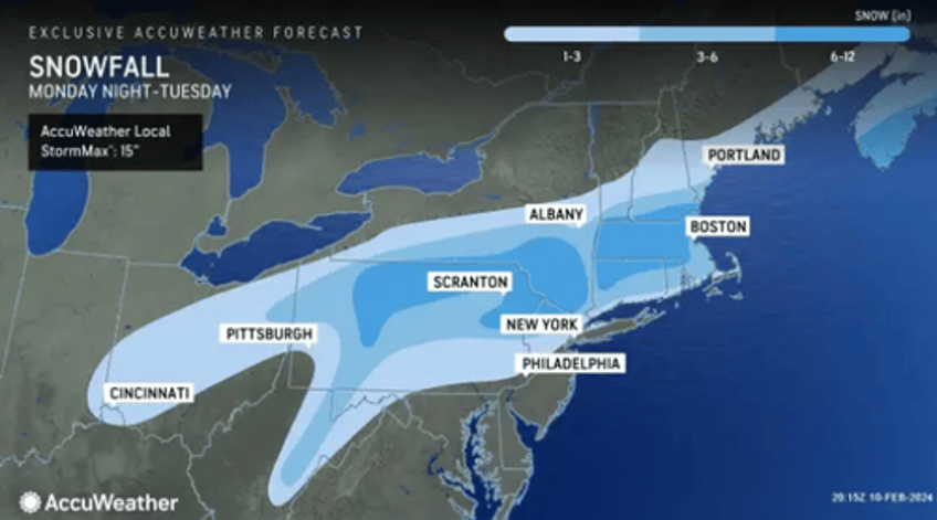
"The way the cold air will invade the storm it appears the best bet for a heavy snowfall will be from northern Pennsylvania to southeastern upstate New York, and southern and central New England, especially from northeastern Pennsylvania on to the east from Monday night to Tuesday evening," AccuWeather Chief On-Air Meteorologist Bernie Rayno said.
Richmond, Virginia, Washington, DC and Baltimore are forecasted to receive mostly rain. Philadelphia might receive a coating, with higher odds of a few inches in northern and western suburbs. On Monday night, New York City, Manhattan could receive upwards of 2 inches. As for Boston and Hartford, Connecticut, these areas could expect meaningful snowfall.
More from Accuweather on the snow forecast:
The Poconos in northeastern Pennsylvania and the Endless Mountains along Pennsylvania's northern tier are likely to pick up 6-10 inches of snow, while the lower elevation cities along the Susquehanna River, like Harrisburg and Wilkes-Barre, Pennsylvania, may struggle to pick up 3 inches of slush. Other spots with the best chance for 6-10 inches of snow and locally higher amounts include the Catskills of eastern New York and much of Massachusetts, including the hills west of Boston.
"For much of the central Appalachians to central and southern New England, accumulations will be highly dependent on elevation, where hilly areas and the mountains will pick up much more snow than the valleys or immediate coastal places," AccuWeather Senior Meteorologist Adam Douty said.
Here's what other meteorologists on X are saying about the upcoming storm:
much stronger.... NYC and juuuuust north gets heavy snow on this run pic.twitter.com/97TgPgcbFI
— NsfwWx ❄️ (@NsfwWx) February 11, 2024
National Weather Service forecasts updating for Nor'easter storm event 💣❄️
— Ryan Maue (@RyanMaue) February 11, 2024
Boston 10.4" 📈
NYC 1.5"
Maximum location would receive: 14.1" pic.twitter.com/LKot5jxu10
The impact map for tomorrow night through Tuesday has been updated! Premium Consulting Members, the impact map in the Premium Dashboard is zoomable down to your street! #nywx #njwx #pawx #ctwx pic.twitter.com/t0IBso6a0k
— NY NJ PA Weather (@nynjpaweather) February 11, 2024
Could it be... a Bulls-eye in the Wyoming Valley???
— Mark Margavage (@MeteoMark) February 11, 2024
No. Probably not.#PAwx #wxtwitter #NEPA #wxX pic.twitter.com/5AawkzRd1K
Meanwhile, Punxsutawney Phil - the famous groundhog weather oracle - might have been wrong in his early spring forecast.


