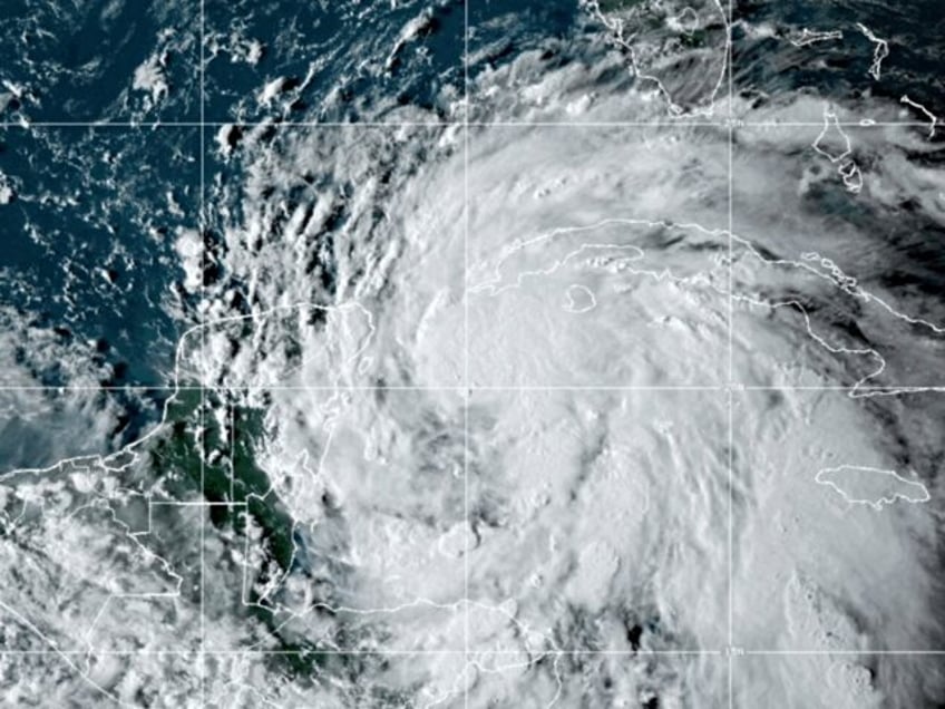
The storm system currently hovering around the Yucatán Peninsula has officially strengthened into a hurricane, and Florida Gov. Ron DeSantis is warning Floridians the impacts of the storm will be widespread, far outside the cone of uncertainty.
The 11 a.m. update from the National Hurricane Center (NHC) now show Helene as a hurricane, expected to make landfall somewhere around the Sunshine State’s Big Bend region as a major storm.
NHC warns that the storm is extremely large, and because of that, the danger of “life-threading storm surge along the entire west coast of the Florida Peninsula and Florida Big Bend” is a reality. There is a storm surge forecast for the entire west coast of Florida, with some predictions as high as 15 feet in specific areas. Peak storm surge of up to 3 feet is predicted for northeast Florida well into Georgia and South Carolina as well.
“Devastating hurricane-force winds are expected across portions of northern Florida and southern Georgia here the core of Helene moves inland,” NHC warns, noting that tropical storm conditions will begin Thursday
“Because of Helen’s expected fast forward speed, damaging and life-threatening wind gusts are expected to penetrate well inland over portions of the southeastern United States, including in the higher terrain of the southern Appalachians,” according to NHC.
Florida Gov. Ron DeSantis held a press conference Wednesday morning and warned that impacts of the storm will go far beyond the cone.
“We now have 61 of Florida’s 67 counties that are in a state of emergency,” he said, noting that they also received a partial approval of a pre-landfall emergency declaration from FEMA.
“We are going to have a significant impact from this storm,” DeSantis said during the press conference, which was held before the 11 a.m. update upgrading the storm to a hurricane.
“The models vary on how intense, but there’s clearly a pathway for this to rapidly intensify prior to making landfall. You’ll see these cones that get produced by the National Hurricane Center. You see these spaghetti models that get put out that I see online, and that’s fine, and you should look at that, but just understand this is a very big storm,” he warned, adding, “You’re going to have impacts that are far outside of what a spaghetti model would have or what a cone would have.”
“Here in the Tampa Bay area, none of those spaghetti models or cones necessarily have the eye of the storm hitting Tampa Bay. But even if it’s 100 or 200 miles off the coast, you are going to see impacts with storm surge. You’re going to see impacts with flooding. And so just be prepared for that,” he added, urging residents to heed local warnings.
“And even though southeast Florida was not in our 61 counties, the coastal southeast part of Florida, they are probably going to end up with tropical storm force winds as well. So it’s a big, big storm has the potential to have a lot of impacts,” DeSantis added.
WATCH:
