Snow, sub-zero temperatures, and frigid wind chills.
Around 30 states and nearly 50 million people could experience temperatures below minus 10 degrees next week as a lobe of the polar vortex moves in. pic.twitter.com/5w06durF8k
— Ben Noll (@BenNollWeather) January 17, 2025
The week ahead will have all of that. Spring is just… two months away.
It could easily turn out to be the coldest week of the year in the Hudson Valley as a lobe of the polar vortex, which typically sits near Greenland, swirls across the country. Watch:
A lobe of the polar vortex swirls 3,000 miles from Greenland to the United States: pic.twitter.com/qoaM5jwR9K
— Ben Noll (@BenNollWeather) January 16, 2025
A winter storm warning is in effect starting Sunday afternoon. It’ll turn out to be a good, old-fashioned snowstorm for the area.
Here’s what you need to know
What? Snow, moderate to heavy at times.
When? Starting between 1 and 4 p.m. Sunday from southwest to northeast. Ending by 4 a.m. Monday.
How much? 4 to 8 inches of powdery snow.
#HudsonValley storm update ☃️
— Ben Noll (@BenNollWeather) January 19, 2025
What? Snow, heaviest on Sunday evening.
When? Starting between 1 and 4 p.m. Sunday from southwest to northeast. Ending by 4 a.m. Monday.
How much? 4 to 8 inches of powdery snow.
Roads will become slippery and snow-covered on Sunday afternoon. pic.twitter.com/0j3t4Dq3fX
Impact? Roads and sidewalks will become snow-covered on Sunday afternoon. The heaviest snow will fall during the evening, when snow rates could reach an inch per hour and travel will be most treacherous. Temperatures will drop into the single digits early Monday as the storm departs. The powdery nature of the snow will make it easier to clear.
The week ahead
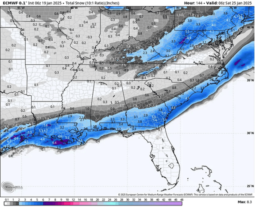
The rest of the week looks very cold but probably dry in the Hudson Valley. Wintry weather is expected from Texas to the Carolinas on Tuesday and Wednesday, with travel grinding to a halt as a major storm brings snow to places that don’t have plows! Houston, New Orleans, Tallahassee, Charleston, and Myrtle Beach are among the places where significant snow may fall.
It could be the biggest snow storm on record in parts of the Deep South, where snowfall could eclipse half a foot in some places. The deepest snow depths across that part of the country generally happened decades ago, so the event will be unusual and rare.
* * *
Here's our latest reporting on the polar vortex and energy markets:
Goldman: "Cold January" & "Record LNG Demand" Drive Upside Risk In Natty Prices
Incoming: "Big Dumps Of Cold Air. Reminiscent Of 2013/14 Winter"
Doesn't Fit MSM Narrative: Parts Of US Could Rival Coldest January Since 1977
Brrr!

