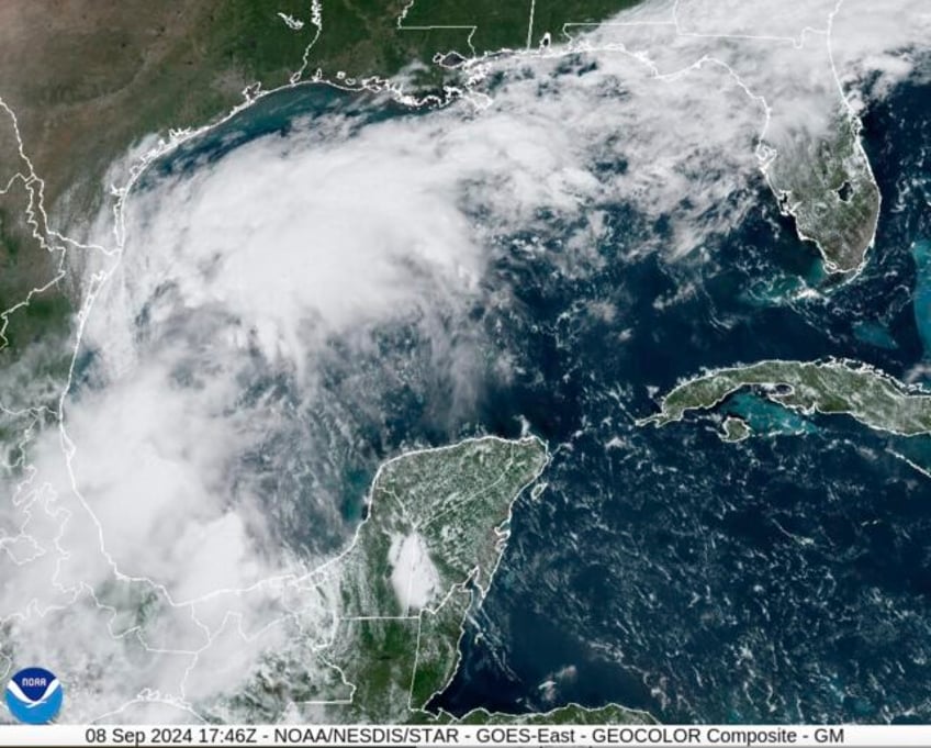
The National Weather Service says a tropical disturbance in the southwestern Gulf of Mexico is forecast to bring significant rainfall to parts of Texas and Louisiana this week
Tropical system set to drench parts of Gulf Coast, could strengthen, forecasters sayBy JUAN A. LOZANOAssociated PressThe Associated PressHOUSTON
HOUSTON (AP) — A tropical disturbance in the southwestern Gulf of Mexico was forecast to bring significant rainfall to parts of Texas and Louisiana this week and was expected to develop into a tropical storm and possibly even a hurricane, the National Weather Service says.
The system was forecast to drift slowly northwestward during the next couple of days, moving near and along the Gulf coasts of Mexico and Texas, the weather service said Sunday.
“A tropical storm is expected to form during the next day or so,” the weather service said Sunday afternoon.
Donald Jones, a meteorologist with the National Weather Service in Lake Charles, Louisiana, said during a weather briefing Saturday night that parts of Southeast Texas and southwest Louisiana should expect a “whole lot” of rain in the middle and later part of this week.
“Definitely want to continue to keep a very close eye on the forecast here in the coming days because this is something that could develop and evolve fairly rapidly. We’re looking at anything from a non-named just tropical moisture air mass all the way up to the potential for a hurricane,” Jones said.
Warm water temperatures and other conditions in the Gulf of Mexico are favorable for storm development, Jones said.
“We’ve seen it before, where we have these rapid spin up hurricanes in just a couple of days or even less. So that is not out of the realm of possibility here,” Jones said.
An Air-Force Reserve hurricane hunter aircraft was scheduled to investigate the tropical disturbance later Sunday and gather more data.
The tropical disturbance comes after an unusually quiet August and early September in the current Atlantic hurricane season, which runs through Nov. 30. The season was set to peak on Tuesday, Jones said.
So far, there have been five named storms this hurricane season, including Hurricane Beryl, which knocked out power to nearly 3 million homes and businesses in Texas — mostly in the Houston area — in July. Experts had predicted one of the busiest Atlantic hurricane seasons on record.
In a report issued last week, researchers at Colorado State University cited several reasons for the lull in activity during the current hurricane season, including extremely warm upper level temperatures resulting in stabilization of the atmosphere and too much easterly wind shear in the eastern Atlantic.
“We still do anticipate an above-normal season overall, however, given that large-scale conditions appear to become more favorable around the middle of September,” according to the report.
Last month, the National Oceanic and Atmospheric Administration updated its outlook but still predicted a highly active Atlantic hurricane season. Forecasters tweaked the number of expected named storms from 17 to 25 to 17 to 24.
