The National Hurricane Center reports around 1100 ET that Helene has reached hurricane status and is expected to produce "life-threatening storm surge, damaging winds, and flooding rains to a large portion of Florida and the southeast US."
11AM EDT Sep 25: #Helene becomes a Hurricane. Helene is expected to bring life-threatening storm surge, damaging winds, and flooding rains to a large portion of Florida and the southeast U.S. Make sure to stay up to date with the latest forecast as we move throughout the event at… pic.twitter.com/aiDCNlravO
— National Hurricane Center (@NHC_Atlantic) September 25, 2024
Hurricane Helene is expected to rapidly strengthen over the eastern Gulf of Mexico on Wednesday and ahead of landfall on Thursday evening along the east part of the Florida Panhandle − possibly the Big Bend area.
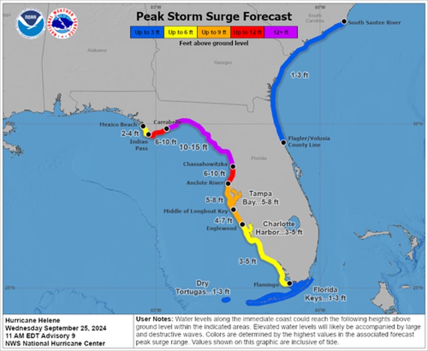
There is a danger of life-threatening storm surge from #Helene along the entire Florida Peninsula and Florida Big Bend, where a Storm Surge Warning is in effect. Residents in those areas should follow advice given by local officials and evacuate if told to do so. pic.twitter.com/WtYuQsfPD4
— National Hurricane Center (@NHC_Atlantic) September 25, 2024
NHC forecasters believe Helene could strengthen to Category 4 status in the Gulf's warm waters.
NEW: The National Hurricane Center is now projecting at least a high-end Category 3, but is considering upgrading their forecast to reflect a Category 4 landfall. #Helene pic.twitter.com/hEhYL1WGsJ
— Matthew Cappucci (@MatthewCappucci) September 25, 2024
This would mean the storm would achieve devastating maximum sustained winds between 130 and 156 mph
Such a massive storm pic.twitter.com/GhUwalBegW
— Hurricane Chaser Chase (@hurricane_chase) September 25, 2024
Some areas along the Big Bend could experience a storm surge of nearly 15 feet.
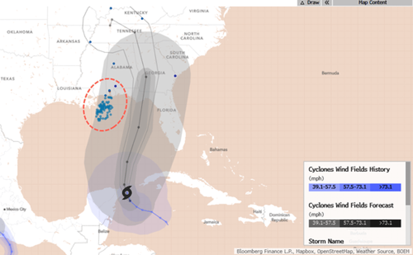
Bloomberg data shows Helene will track just right of major oil/gas infrastructure in the Gulf and onshore.
After landfall, the storm could track into the southern Appalachian area, unleashing extreme winds and torrential rains.
As many have noted, #Helene wind+rain impacts will be extreme into the southern Appalachians.
— World Climate Service (@WorldClimateSvc) September 25, 2024
Model 850mb winds look potentially comparable to Opal, Irma, and Zeta (historically damaging N Georgia storms).
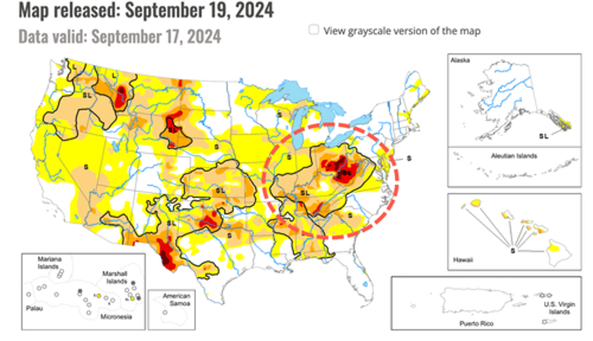
Current drought in the region will reduce impacts just a bit. pic.twitter.com/R5Jjx2wHvj
Some parts of the Appalachians are in desperate need of rain.
Here's our reporting on the storm:
Gov. DeSantis Declares State Of Emergency Ahead Of Dangerous Hurricane Threat
Tropic Trouble Brewing In Gulf Of Mexico Could "Slingshot" Towards Offshore Oil Rigs
"Something Brewing In Gulf Of Mexico" As Confidence Grows In Cyclone Formation Next Week
*Developing...


