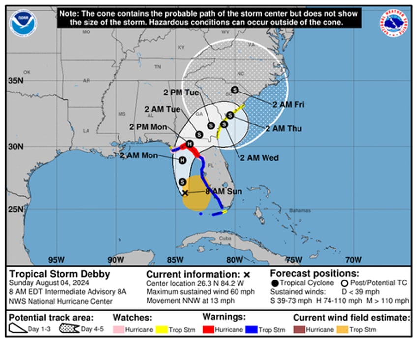
The National Hurricane Center released an early Sunday update about Tropical Storm Debby, indicating the storm is "expected to strengthen rapidly before landfall in the Florida Big Bend Region."
Tropical Storm #Debby Advisory 8A: Debby Expected to Strengthen Rapidly Before Landfall in the Florida Big Bend Region. https://t.co/tW4KeGe9uJ
— National Hurricane Center (@NHC_Atlantic) August 4, 2024
As of 0800 ET, NHC said Debby was located about 155 miles southwest of Tampa, Florida. The storm was moving north-northwest at 13 mph with maximum sustained winds of 60 mph. It is expected to strengthen into a hurricane with landfall this evening.
"Conditions favor strengthening over the Gulf of Mexico with warm sea surface temperatures and light shear. Intensification is likely to be slow during the first 12–24 hours, then proceed at a faster rate after the cyclone develops an organized inner core," NHC said.
Officials in Florida and Georgia warned residents to prepare for tropical storm/hurricane conditions late Sunday night or Monday morning.
"I'd urge all Floridians to be cognizant of the fact that we are going to have a hurricane hit the state, probably a Category 1, but it could be a little bit more powerful than that," Florida Gov. Ron DeSantis said early Sunday.
"But we are absolutely going to see a lot of rainfall. We are going to see a lot of saturation. We are going to see flooding events. That is going to happen. There is also going to be power outages," DeSantis said.
NHC has posted a timeline for Debby's future potential track.
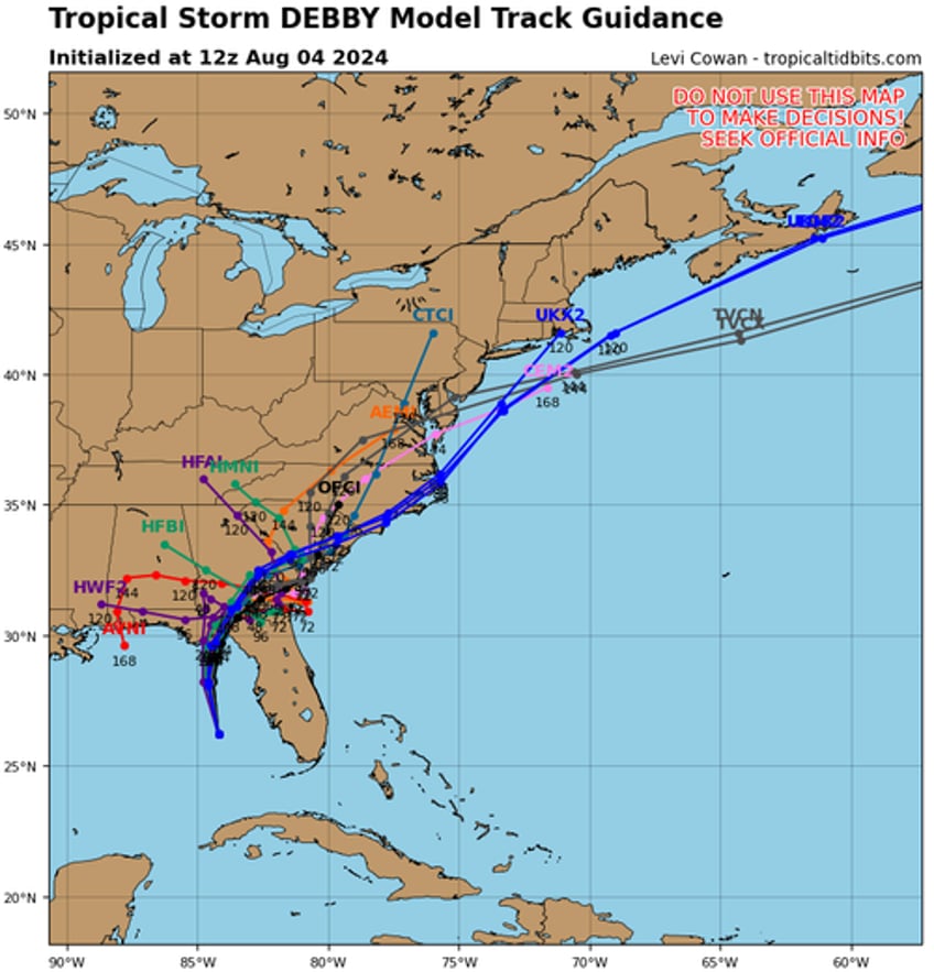
Weather models show Debby's future potential track will likely ride the East Coast shoreline next week.
Folks in the Mid-Alantic region see the tropical threat as a welcoming sign of rain amid severe droughts this summer.


